 ORMA
the valley-floor walk up the Vallunga
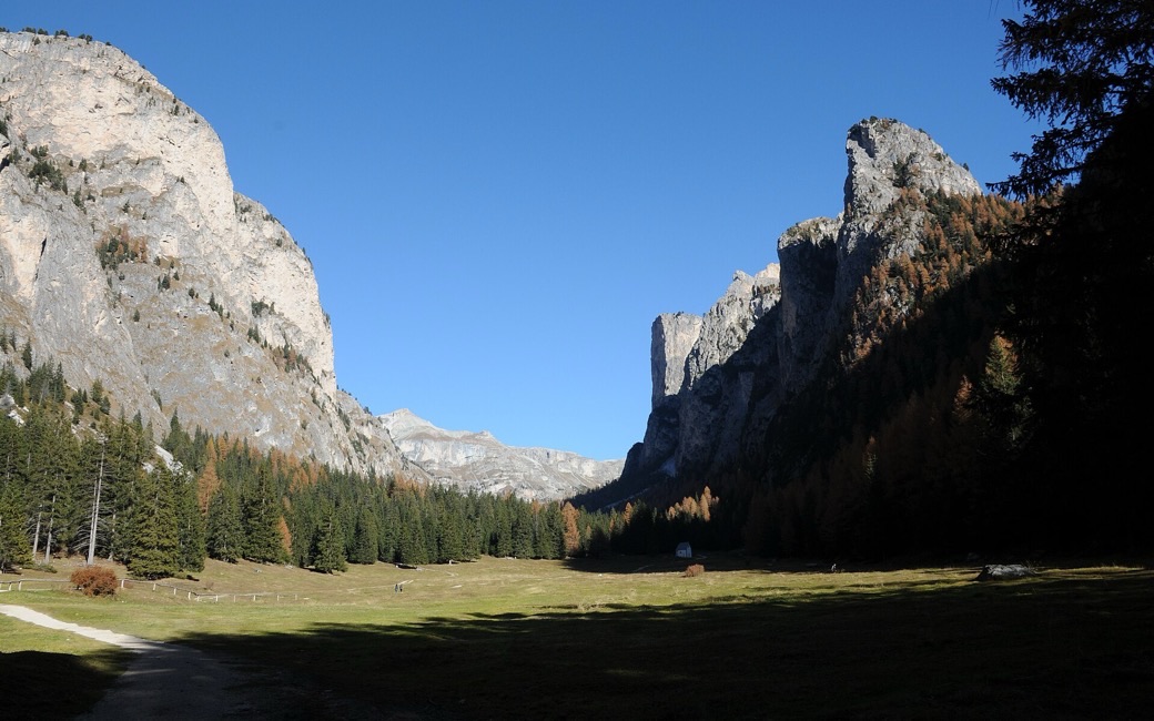
An easy out-and-back up the Vallunga above Selva, past the San Silvestro chapel to the pastures under the valley’s limestone walls, in the Puez-Odle nature park. The board lists 7.5 km and 201 m of ascent.
Recommended all year.
Source: Val Gardena tourist board, read on 6 November 2026.
In winter, 5.9 km of this walk is a cross-country ski track. Expect skiers there while the runs are open, usually from December to April (an estimate).
Read off the map (OpenStreetMap).
June to September (an estimate): cows may be out on the pastures. Keep your dog close and give the herds a wide berth.
Source: South Tyrol tourist board, read on 9 November 2026.
The mouth of the Vallunga, Selva di Val Gardena, the board’s start
Directions: Path 14: from the mouth of the Vallunga up the valley on path 14 to the San Silvestro chapel, then through tall larch and stone-pine forest with benches and tables; the valley narrows among dwarf pines and opens again onto the pastures at the foot of steep walls. Back the same way.
From ORMA's route audit of the official route description. Follow the mapped ORMA line and local signs.
Start at the mouth of the Vallunga above Selva: 7.5 km and about 200 m of climbing there and back, two hours. Keep your dog on a lead of at most 1.5 m and carry a muzzle, as Selva and the nature park require. The valley floor is open, so go early on hot days and carry water for the far end.
The trail rating above describes the mountain, and it's the same for every dog. How it suits yours depends on their build, age and health. See this route's match — scored for a medium dog until you add your own, free and in a minute.
Before you go: the dog safety guide · water for dogs on trail · dogs on cable cars · meeting a guardian dog
Planning a few days here? Read our area guide: Dog-friendly hikes in Val Gardena.
