ORMA logoORMA
All trails › Dolomites, Italy › Val Gardena

Troi da la Tambres, Ortisei

a meadow and forest path to the La Tambres farm above Ortisei and back
Best time: March to November Higher risk Verified by ORMA
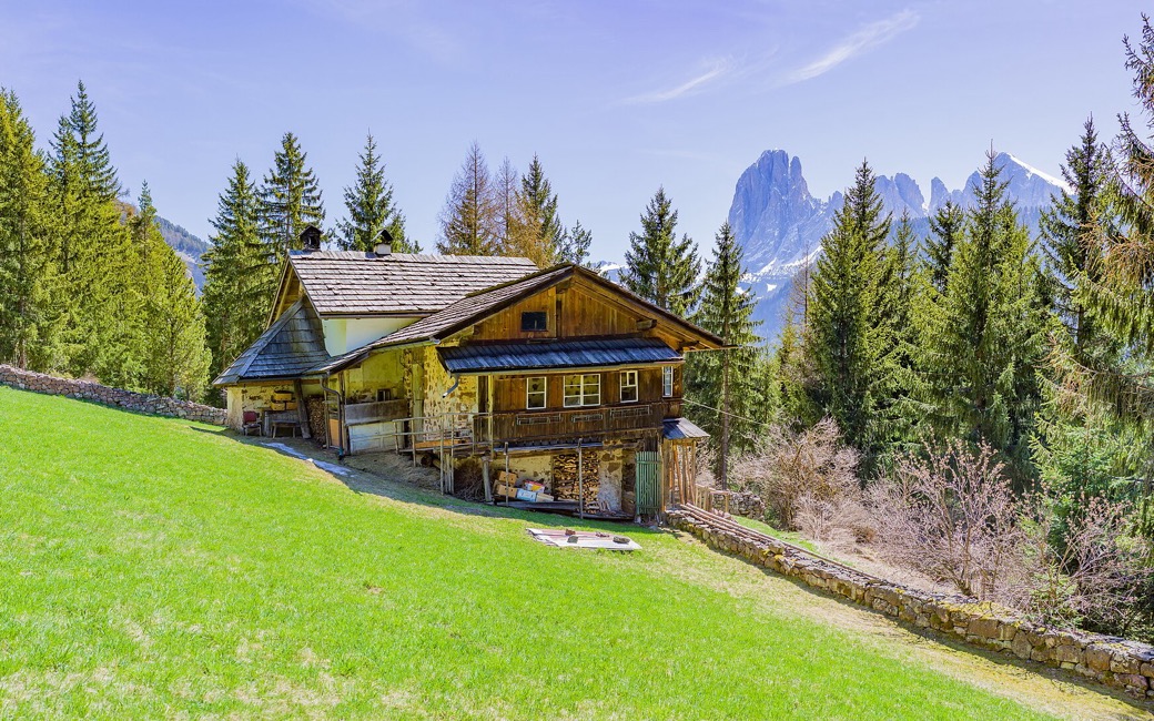
An old wooden farmhouse with a shingle roof on a bright green meadow, framed by spruce trees, with the jagged Langkofel peak rising behind under a blue sky
C
The La Tambres farmhouse below the Langkofel by Wolfgang Moroder CC BY-SA 4.0 Cropped for display.

An easy walk above Ortisei on path 10A, the Troi da la Tambres: along two farm lanes past the Costes farms, then through meadows and forest to the old La Tambres farmhouse below the Langkofel, and back the same way. It is about 3.3 km with some 110 m of up and down, as measured by ORMA (the province register gives only the length).

Distance
1.7 km
Elevation gain
≈ 41 m
Highest point
1506 m
Duration
Not given
Terrain
Lanes, a meadow and forest path and a short mountain path
Trail rating
Higher risk
Area
Costes – La Tambres, Ortisei / St. Ulrich · Dolomites, Italy
Distance
3.3 km
Elevation gain
108 m
Highest point
1506 m
Duration
1 h 5 min
Terrain
Lanes, a meadow and forest path and a short mountain path
Trail rating
Higher risk
Area
Costes – La Tambres, Ortisei / St. Ulrich · Dolomites, Italy

Ends away from the start: plan a lift, bus or second car back.

Back the same way on the same path.

Open the full trail guide →
1506 m 1436 m 3.3 km
Elevation profile: lowest 1436 m, highest 1506 m.

When to go

  1. January: Snow possible
  2. February: Snow possible
  3. March: Usually snow-free
  4. April: Usually snow-free
  5. May: Usually snow-free
  6. June: Usually snow-free
  7. July: Usually snow-free
  8. August: Usually snow-free
  9. September: Usually snow-free
  10. October: Usually snow-free
  11. November: Usually snow-free
  12. December: Snow possible

Snow is possible here from December to February.

Estimated from the walk’s high point (1506 m). No tourist board publishes this walk’s season, and every winter is different.

Where to start

At the Martin farm on the Streda Cuca above Ortisei

How to follow this route

This walk has no trail number of its own: follow these landmarks

Start at the Martin farm on the Streda Cuca above Ortisei, by the bus stop on the Ortisei–Costamula line; path 10A is waymarked from here.

  1. The Martin farm on the Streda Cuca, by the bus stop
  2. The Streda Costes lane past the Ronch, Raineles and Còsta farms to La Mauta
  3. Path 10A, the Troi da la Tambres, through meadows and forest to the La Tambres farm
  4. The narrower mountain path to the junction with path 10, then back the same way

Directions: Autonome Provinz Bozen, hiking-trail register, checked 18 November 2026.

Water on trail

Good to know

An easy 3.3 km there and back with about 110 m of up and down, roughly an hour. Keep your dog on a lead of at most 1.5 m and carry a muzzle, as Ortisei requires, and stay off the meadows. The last 300 m before the turn is a narrower mountain path: keep your dog close. No mapped water, so bring some.

Verified by ORMA on 18 Nov 2026. Check current conditions before setting out.

Is this trail right for your dog?

The trail rating above describes the mountain, and it's the same for every dog. How it suits yours depends on their build, age and health. See this route's match — scored for a medium dog until you add your own, free and in a minute.

Before you go: the dog safety guide · water for dogs on trail · dogs on cable cars · meeting a guardian dog

Nearby trails

Planning a few days here? Read our area guide: Dog-friendly hikes in Val Gardena.