 ORMA
the Sexten circular walk
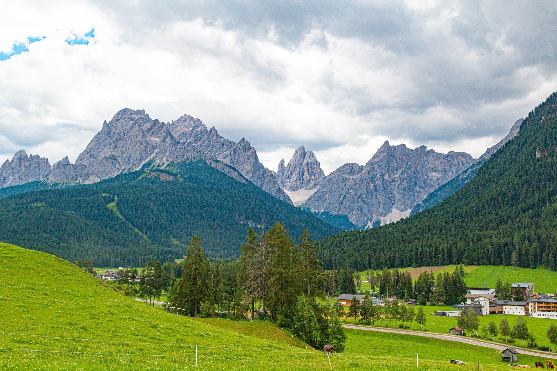
A village loop round Sexten on route 1, the Sextner Rundweg, with views to the Sexten Dolomites: from the Kiniger farms along the meadows towards Moos, past the ski lifts and back through the village. The official circuit is 15 km with 352 m of climbing; the map line here shows about 11 km of it, without the western lobe by the Haideck fort and Waldheim.
The tourist office currently reports the forest path between theme stations 3 (Spitzköfele) and 4 closed: descend from station 3 to Palmstatt instead. About 2.8 km is on village streets and minor roads, with two main-road crossings. Three seasonal fountains are on the way.
Snow is possible here from December to February.
Estimated from the walk’s high point (1450 m). No tourist board publishes this walk’s season, and every winter is different.
In winter, 1.2 km of this walk is a ski run (III - Skiweg Kreuzbergpass-Signaue, 41b, Drei Zinnen - Tre Cime). Expect skiers there while the runs are open, usually from December to April (an estimate).
Read off the map (OpenStreetMap).
December to February (an estimate): the roads and lanes on this walk may be salted when they ice over. Salt hurts dogs’ paws: check them after the walk and rinse them with warm water.
Source: Province of Bolzano weather service, Bozen station temperatures, read on 10 November 2026. German Federal Chamber of Veterinarians, read on 10 November 2026.
Suggested start, Kiniger farms on Kinigerweg above Sexten (official start); bus stop Sexten Helm nearby. Check current access before travelling.
Start at the Kiniger farms (1,375 m) above Sexten, as the tourist office gives; bus stop Sexten Helm.
Trail numbers: Signposted as trail 1, the Sextner Rundweg.
Trail numbers and route: From the Kiniger farms follow route 1 along the meadow edge towards Moos to Palmstatt, past the top of the Brugger lift, round by the Rotwand gondola valley station and back through the village to the Kiniger farms.
Where to switch: None: route 1 is followed round. The forest path between stations 3 and 4 is currently closed; the tourist office gives a detour via Palmstatt.
Do not rely on potential water locations being available or drinkable. Carry enough for the full walk.
Start at the Kiniger farms above Sexten (bus stop Sexten Helm) and follow waymark 1. Check the closure notice on the tourist office page before setting out.
The trail rating above describes the mountain, and it's the same for every dog. How it suits yours depends on their build, age and health. See this route's match — scored for a medium dog until you add your own, free and in a minute.
Before you go: the dog safety guide · water for dogs on trail · dogs on cable cars · meeting a guardian dog
Planning a few days here? Read our area guide: Lago di Braies & Tre Cime with a dog.
