ORMA logoORMA
All trails › Dolomites, Italy › Oltradige – Bassa Atesina

La “scalata” alle Malghette

the forest-road walk to the Malghette hut
Best time: May to October Caution terrain Verified by ORMA
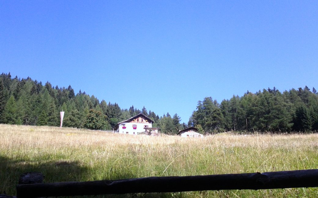
A long summer meadow of tall grass rising to the white hut of Le Malghette at the edge of spruce woods under a clear blue sky
C
Le Malghette (Krabes Alm) by Mario Penner CC BY 3.0 Cropped for display.

A walk from Solaiolo up a forest road past the Palù Longa bog lake to the meadow and hut of Le Malghette, laid out by the APT for all-terrain wheelchairs, and back the same way. The APT lists 3.9 km and 163 m of ascent.

Distance
3.9 km
Elevation gain
163 m
Highest point
1583 m
Duration
2 h
Terrain
A compacted gravel forest road and a short cobbled lane
Trail rating
Caution terrain
Area
Solaiolo – Malghette, Ville di Fiemme and Anterivo / Altrei · Dolomites, Italy
Open the full trail guide →
1583 m 1416 m 3.9 km
Elevation profile: lowest 1416 m, highest 1583 m.

When to go

  1. January: Outside the season
  2. February: Outside the season
  3. March: Outside the season
  4. April: Outside the season
  5. May: Recommended
  6. June: Recommended
  7. July: Recommended
  8. August: Recommended
  9. September: Recommended
  10. October: Recommended
  11. November: Outside the season
  12. December: Outside the season

Recommended from May to October.

Source: Outdooractive, read on 6 November 2026.

For your dog

December to February (an estimate): the roads and lanes on this walk may be salted when they ice over. Salt hurts dogs’ paws: check them after the walk and rinse them with warm water.

Source: Province of Bolzano weather service, Bozen station temperatures, read on 10 November 2026. German Federal Chamber of Veterinarians, read on 10 November 2026.

Where to start

Solaiolo car park, the APT’s start

How to follow this route

This walk has no trail number of its own: follow these landmarks

Start at the Solaiolo car park, the tourist board’s start.

  1. The first climb starts at the car park (up to 18%). At its top there is a small stream on your left.
  2. Then comes the second, longer climb (up to 16%). The road is gravel but firm.
  3. Where it levels out, a short way on, a small gravel lane on the left leads to the shore of the little lake of the Palù Longa biotope, with its water lilies.
  4. Back on the main road, a little further on, there is a small stone hut with boards about local plants and animals by the fence. Ignore the road on the left and go straight on up the third and steepest climb (up to 18%).
  5. Where it levels out, the big meadow begins on your right, with the Le Malghette hut at the top. Go up by the cobbled lane on the right (up to 20%), or stay on the gravel road and turn right following the signs.
  6. Come back the same way. For the first stretch the board suggests the gravel road rather than the cobbles, and to watch out for the drainage channels on the first way down.

Directions: Fiemme and Cembra tourist board, checked 29 October 2026.

Water on trail

Rifugi & refreshment

Good to know

Start at the Solaiolo car park: 3.9 km there and back, 163 m of climbing, about two hours. The Italian rule applies: a lead of at most 1.5 m and a muzzle carried; in the reserve and the nature park keep your dog on the lead and on the path. The Malghette hut serves food at the turn; a fountain near it.

Verified by ORMA on 27 Oct 2026. Check current conditions before setting out.

Is this trail right for your dog?

The trail rating above describes the mountain, and it's the same for every dog. How it suits yours depends on their build, age and health. See this route's match — scored for a medium dog until you add your own, free and in a minute.

Before you go: the dog safety guide · water for dogs on trail · dogs on cable cars · meeting a guardian dog

Nearby trails