ORMA logoORMA
All trails › Dolomites, Italy › Belluno – Agordino

Walk round the Colle di Santa Lucia

a short meadow loop round the village knoll
Best time: April to October Caution terrain Verified by ORMA
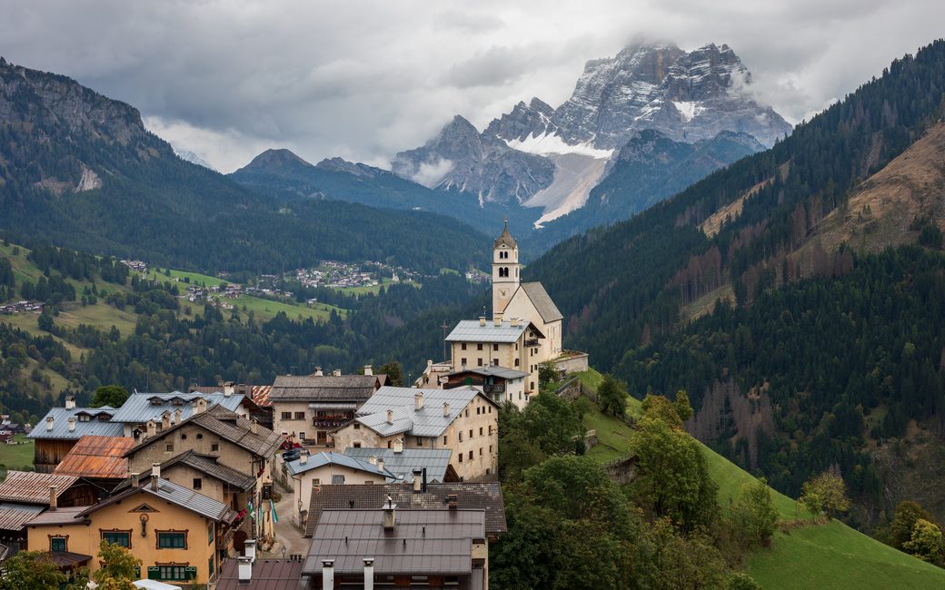
A mountain village of old houses below a white church with a bell tower on a green knoll, forested slopes around and a snow-dusted rocky peak behind
C
Colle Santa Lucia by Ximonic (Simo Räsänen) CC BY-SA 4.0 Cropped for display.

A short, easy loop round the knoll of Colle Santa Lucia, through hay meadows and past the Via Crucis stations, with views of the village church and the Pelmo. The association lists 1.1 km and 59 m up.

Distance
1.1 km
Elevation gain
59 m
Highest point
1460 m
Duration
30 min
Terrain
Village street and forest road
Trail rating
Caution terrain
Area
Colle Santa Lucia, Val Fiorentina · Dolomites, Italy
Open the full trail guide →
1460 m 1381 m 1.1 km
Elevation profile: lowest 1381 m, highest 1460 m.

When to go

  1. January: Outside the season
  2. February: Outside the season
  3. March: Outside the season
  4. April: Recommended
  5. May: Recommended
  6. June: Recommended
  7. July: Recommended
  8. August: Recommended
  9. September: Recommended
  10. October: Recommended
  11. November: Outside the season
  12. December: Outside the season

Recommended from April to October.

Source: Outdooractive, read on 11 November 2026.

For your dog

December to February (an estimate): the roads and lanes on this walk may be salted when they ice over. Salt hurts dogs’ paws: check them after the walk and rinse them with warm water.

Source: Province of Bolzano weather service, Bozen station temperatures, read on 10 November 2026. German Federal Chamber of Veterinarians, read on 10 November 2026.

Where to start

The piazza of Colle Santa Lucia, by the church, the association’s start

How to follow this route

This walk has no trail number of its own: follow these landmarks

Start in the piazza of Colle Santa Lucia, by the church, the association’s start.

  1. The piazza of Colle Santa Lucia
  2. Road down signed “Rovei – Caprile”, between the guesthouse and the old barn
  3. Left after about 200 m onto the forest road through the meadows
  4. Round the knoll past the Via Crucis stations
  5. Back through the old village to the piazza

Directions: Associazione Turistica Colle Santa Lucia, checked 11 November 2026.

Water on trail

Rifugi & refreshment

Good to know

Start in the piazza by the church: 1.1 km and 59 m up, about 25 minutes, as the association lists. A gentle stroll for a short leg-stretch or an older dog; carry water on warm days, as there is almost no shade.

Verified by ORMA on 11 Nov 2026. Check current conditions before setting out.

Is this trail right for your dog?

The trail rating above describes the mountain, and it's the same for every dog. How it suits yours depends on their build, age and health. See this route's match — scored for a medium dog until you add your own, free and in a minute.

Before you go: the dog safety guide · water for dogs on trail · dogs on cable cars · meeting a guardian dog

Nearby trails