 ORMA
the Kronplatz summit panorama loop
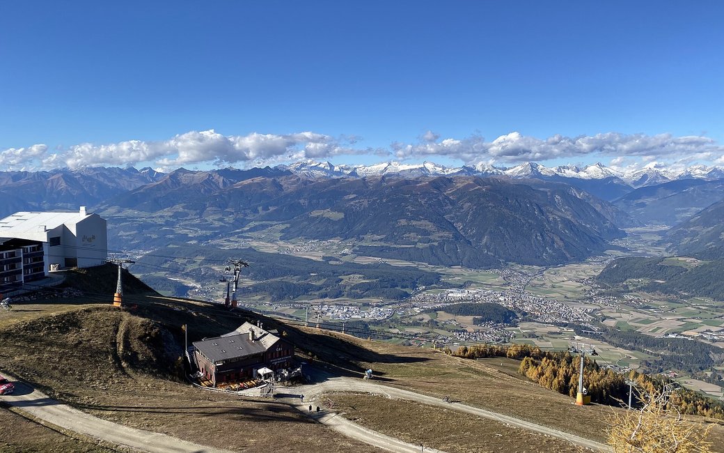
A short family loop round the summit of the Kronplatz at 2,275 m: past the Concordia 2000 peace bell, the MMM Corones and LUMEN museums and a series of viewpoints, with the Dolomites to the south and the main Alpine ridge to the north. The official route lists 2.4 km and 75 m of ascent.
Snow is likely here from November to May.
Estimated from the walk’s high point (2266 m). No tourist board publishes this walk’s season, and every winter is different.
The Kronplatz 2000 gondola (Reischach) runs from 16 May to 8 November (2026 dates; winter dates not yet published). The walk needs it.
Source: Südtirol.com, summer 2026 lift times, read on 10 November 2026.
Cable car top stations on the Kronplatz summit (official start)
Directions: Marked “A” round the summit: from the top stations of the cable cars from Reischach, Olang or the Furkelpass, past the MMM Corones, the LUMEN museum, the Concordia 2000 peace bell and its panorama relief, and the viewpoints designed by Helmut Pizzinini.
From ORMA's route audit of the official route description. Follow the mapped ORMA line and local signs.
Take a cable car up from Reischach, Olang or the Furkelpass and follow the “A” signs round the summit: 2.4 km, about 75 m of climbing, 40 minutes plus time at the museums and the peace bell. Keep your dog on a short lead (1.5 m at most) and carry a muzzle, also in the cable car. There is no shade and the summit is exposed to sun and wind, so bring water and something warm.
The trail rating above describes the mountain, and it's the same for every dog. How it suits yours depends on their build, age and health. See this route's match — scored for a medium dog until you add your own, free and in a minute.
Before you go: the dog safety guide · water for dogs on trail · dogs on cable cars · meeting a guardian dog
Planning a few days here? Read our area guide: Lago di Braies & Tre Cime with a dog.
