ORMA logoORMA
All trails › Dolomites, Italy › Val di Susa

Orrido and Chouqué di Margrit, Chianocco

a loop past a gorge and an eroded rock tower in the Chianocco reserve
Best time: September to June Higher risk Verified by ORMA
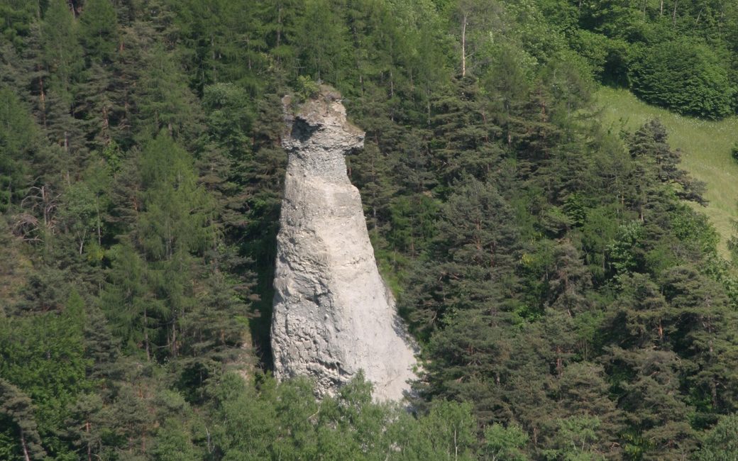
A tall pale tower of eroded rock and gravel with a cap stone on top, standing among dense green pine and broadleaf woods on a steep slope
C
The Chouqué di Margrit above Chianocco by Sbaluf CC BY-SA 4.0 Cropped for display.

A loop on the sunny slopes above Chianocco, partly in the Orrido di Chianocco reserve, to the Chouqué di Margrit, a tall tower of eroded glacial debris, and the gullies of the Calanchi del Molè. The board lists 8.5 km and 559 m up.

Distance
8.5 km
Elevation gain
559 m
Highest point
1098 m
Duration
3 h 30 min
Terrain
Mountain paths, gravel road and hamlet lanes
Trail rating
Higher risk
Area
Chianocco – Pavaglione – Margrit – Goitroce – Molè (Val di Susa) · Dolomites, Italy
Open the full trail guide →
1098 m 546 m 8.3 km
Elevation profile: lowest 546 m, highest 1098 m.

When to go

  1. January: Recommended
  2. February: Recommended
  3. March: Recommended
  4. April: Recommended
  5. May: Recommended
  6. June: Recommended
  7. July: Outside the season
  8. August: Outside the season
  9. September: Recommended
  10. October: Recommended
  11. November: Recommended
  12. December: Recommended

Recommended from September to June.

Source: Outdooractive, read on 19 November 2026.

Where to start

The square by the town hall, Chianocco, the board’s start

How to follow this route

This walk has no trail number of its own: follow these landmarks

Start at the square by the town hall in Chianocco, the board’s start.

  1. The square by the town hall, Chianocco
  2. Path 541 up to Pavaglione
  3. The gravel road to Margrit and the Chouqué di Margrit
  4. The lane to Goitroce and Molè, past the Calanchi del Molè
  5. Path 565 down through the reserve to Chianocco

Directions: Val Susa Outdoor, checked 19 November 2026.

Rifugi & refreshment

Good to know

Start at the square by the town hall in Chianocco: 8.5 km and 559 m up, about 3 hours 35 minutes, as the board lists. Best in autumn, winter and spring: the board warns it is too hot in high summer.

Verified by ORMA on 19 Nov 2026. Check current conditions before setting out.

Is this trail right for your dog?

The trail rating above describes the mountain, and it's the same for every dog. How it suits yours depends on their build, age and health. See this route's match — scored for a medium dog until you add your own, free and in a minute.

Before you go: the dog safety guide · water for dogs on trail · dogs on cable cars · meeting a guardian dog

Nearby trails