ORMA logoORMA
All trails › Dolomites, Italy › Primiero – Pale

Passeggiata a Monte Vederna – Croce degli Alpini

the walk from the Rifugio Vederna to the Croce degli Alpini
Best time: March to November Caution terrain Reviewed by ORMA
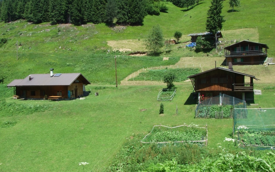
Wooden mountain huts on a steep green meadow with vegetable gardens and fenced plots, fir forest above, in bright summer light
C
The huts of Vederna by Tn4196 CC BY-SA 3.0 Cropped for display.

A walk from the Rifugio Vederna along a forest road and meadows to the Croce degli Alpini, a great cross above the Primiero valley with views of the Pale di San Martino and the Vette Feltrine. The APT lists 8.2 km and 300 m of ascent.

Distance
8.2 km
Elevation gain
300 m
Highest point
1560 m
Duration
2 h
Terrain
Gravel forest road and a short meadow path
Trail rating
Caution terrain
Area
Monte Vederna – Croce degli Alpini, Imer · Dolomites, Italy
Open the full trail guide →
1560 m 1330 m 8 km
Elevation profile: lowest 1330 m, highest 1560 m.

When to go

  1. January: Snow possible
  2. February: Snow possible
  3. March: Usually snow-free
  4. April: Usually snow-free
  5. May: Usually snow-free
  6. June: Usually snow-free
  7. July: Usually snow-free
  8. August: Usually snow-free
  9. September: Usually snow-free
  10. October: Usually snow-free
  11. November: Usually snow-free
  12. December: Snow possible

Snow is possible here from December to February.

Estimated from the walk’s high point (1560 m). No tourist board publishes this walk’s season, and every winter is different.

For your dog

March to April: pine processionary caterpillars come down from the pines below about 1400 m, and they are a danger to dogs. Keep your dog away from pines and from the caterpillars.

Source: Province of Trento, forestry service, read on 9 November 2026.

Where to start

The Rifugio Vederna (1,324 m), the APT’s start

How to follow this route

This walk has no trail number of its own: follow these landmarks

Start at the Rifugio Vederna, the tourist board’s start.

  1. From the Rifugio Vederna, take the forest road signed “Croce degli Alpini”. It climbs gently to the meadows near Cima Vederna, on the left of the clearing.
  2. On the level meadow, follow the easy marked path on the right to the huge metal cross above the Primiero valley: the Croce degli Alpini.
  3. Come back the same way.

Directions: San Martino di Castrozza, Primiero and Vanoi tourist board, checked 29 October 2026.

Water on trail

Rifugi & refreshment

Good to know

Start at the Rifugio Vederna, reached by long forest roads from Pontet or the Val Noana (ask the rifugio about their state): 8.2 km there and back, 300 m of climbing, two hours. Water at the rifugio; carry some for your dog on the way.

Reviewed by ORMA on 26 Oct 2026. Check current conditions before setting out.

Is this trail right for your dog?

The trail rating above describes the mountain, and it's the same for every dog. How it suits yours depends on their build, age and health. See this route's match — scored for a medium dog until you add your own, free and in a minute.

Before you go: the dog safety guide · water for dogs on trail · dogs on cable cars · meeting a guardian dog

Nearby trails