ORMA logoORMA
All trails › Dolomites, Italy › Primiero – Pale

San Martino di Castrozza - Malga Crel

the forest walk from San Martino to Malga Crel
Best time: May to November Caution terrain Reviewed by ORMA
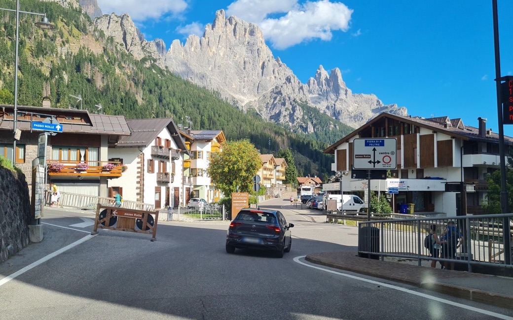
A road junction in San Martino di Castrozza with signs to Passo Rolle, chalets with flower boxes and walkers, the jagged pale towers of the Pale di San Martino rising above the forest
C
San Martino di Castrozza and the Pale by laniuscollurio CC BY-SA 4.0 Cropped for display.

A walk from San Martino di Castrozza past the Prà delle Nasse bog and through the forest to Malga Crel and back, with views of the Pale di San Martino. The APT lists 9.2 km and 260 m of ascent.

Distance
9.2 km
Elevation gain
260 m
Highest point
1611 m
Duration
2 h 30 min
Terrain
Forest roads and paths, with some tarmac in the village
Trail rating
Caution terrain
Area
San Martino di Castrozza – Malga Crel, Primiero San Martino di Castrozza · Dolomites, Italy
Open the full trail guide →
1611 m 1468 m 9 km
Elevation profile: lowest 1468 m, highest 1611 m.

When to go

  1. January: Snow likely
  2. February: Snow likely
  3. March: Snow likely
  4. April: Snow likely
  5. May: Usually snow-free
  6. June: Usually snow-free
  7. July: Usually snow-free
  8. August: Usually snow-free
  9. September: Usually snow-free
  10. October: Usually snow-free
  11. November: Usually snow-free
  12. December: Snow likely

Snow is likely here from December to April.

Estimated from the walk’s high point (1611 m). No tourist board publishes this walk’s season, and every winter is different.

For your dog

December to February (an estimate): the roads and lanes on this walk may be salted when they ice over. Salt hurts dogs’ paws: check them after the walk and rinse them with warm water.

Source: Province of Bolzano weather service, Bozen station temperatures, read on 10 November 2026. German Federal Chamber of Veterinarians, read on 10 November 2026.

Where to start

The Prà delle Nasse car park, the APT’s start

How to follow this route

This walk has no trail number of its own: follow these landmarks

Start at the Prà delle Nasse car park, the tourist board’s start.

  1. From the Prà delle Nasse car park, take the road up towards Malga Ces for a few metres, then turn left following the signs “O piccolo”.
  2. Follow the path beside the Prà delle Nasse bog; it soon brings you to the Ces lift area (the Colbricon Express gondola station).
  3. Carry on towards the Ostello San Martino, then take the forest road that climbs on the right. At the top of the climb, follow the signs for the Lago di Calaita to the fork for Malga Crel. The last climb leads straight to the malga, with a view of the Pale di San Martino.
  4. To come back, follow the forest road down to the campsite, then head for the sports hall (Palazzetto dello Sport) and back to the start.

Directions: San Martino di Castrozza, Primiero and Vanoi tourist board, checked 29 October 2026.

Water on trail

Rifugi & refreshment

Good to know

Start at the Prà delle Nasse car park in San Martino: 9.2 km there and back, about 260 m of climbing, two and a half hours. Keep your dog on a lead in the park and on the path past the bog. Fountains at the start; Malga Fratazza and Malga Crel are on the way.

Reviewed by ORMA on 26 Oct 2026. Check current conditions before setting out.

Is this trail right for your dog?

The trail rating above describes the mountain, and it's the same for every dog. How it suits yours depends on their build, age and health. See this route's match — scored for a medium dog until you add your own, free and in a minute.

Before you go: the dog safety guide · water for dogs on trail · dogs on cable cars · meeting a guardian dog

Nearby trails