 ORMA
a loop from the lake up an old mule track to Solto Collina and back down beside the Bogn gorge to the lakeside
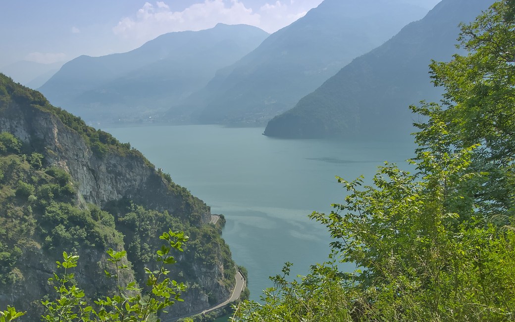
A varied loop from the lakeside village of Riva di Solto up an old mule track to Solto Collina, along the Sebino nature path with wide views over Lake Iseo, Monte Isola and the Corna Trentapassi, and back down a stepped path beside the Bogn gorge to the lakeside promenade. Visit Lake Iseo lists 6.7 km, 290 m up and down, 2 h 30.
Usually snow-free all year. After a cold spell, snow can lie for a few days from December to February.
Estimated from the walk’s high point (476 m). No tourist board publishes this walk’s season, and every winter is different.
Winter sun: On the shortest day the sun reaches this walk for about 6 hours.
Worked out from the terrain alone (AWS Terrain Tiles): trees, buildings and weather are not counted.
The car park on Via Papa Giovanni XXIII by the lake in Riva di Solto, the published start
Start at the car park on Via Papa Giovanni XXIII in Riva di Solto, by the lake, the published start.
Trail numbers and route: Walk about 150 m along Via Papa Giovanni XXIII (the SP 77), then turn left onto the old mule track (CAI path 567) that climbs towards Solto Collina. After about 15 minutes, at Zangolo, turn right, ignoring the signs for the giant bench. At the top of the climb turn right into Via Dosso (wooden sign “Sentiero Natura del Sebino”, CAI path 565) to the church of Santi Rocco e Antonio Abate, then right into Via Sconico; after 100 m turn left and cross the SP 77 at the pedestrian crossing. Follow the signs of the Sentiero Naturalistico del Sebino towards Lovere, on lanes and on cobbled and grassy paths out of Solto Collina, with Monte Isola and the Corna Trentapassi on your right. After about 1.5 km, at the asphalt Via Apostoli, turn right downhill round two hairpins to the start, on the left, of the “Sentiero alla scoperta del Bogn”. Follow it down beside the gorge on a stepped path to the road by the Riva di Solto tunnel, cross with great care, and turn right along the lakeside promenade of Riva di Solto back to the start.
Where to switch: Via Papa Giovanni XXIII (SP 77) for about 150 m; left on the old mule track, CAI 567, towards Solto Collina; right at Zangolo; right into Via Dosso, CAI 565 (Sentiero Natura del Sebino), past the church of Santi Rocco e Antonio Abate and right into Via Sconico; left and across the SP 77; the Sentiero Naturalistico del Sebino towards Lovere; right down Via Apostoli; left onto the Sentiero alla scoperta del Bogn down to the road by the tunnel; across it, then right along the lakeside promenade to the start.
Park on Via Papa Giovanni XXIII in Riva di Solto: 6.7 km and 290 m up and down, about 2 h 30 as the board gives. Cross the road by the tunnel with care and keep your dog on a lead in the villages. Carry a muzzle.
The trail rating above describes the mountain, and it's the same for every dog. How it suits yours depends on their build, age and health. See this route's match — scored for a medium dog until you add your own, free and in a minute.
Before you go: the dog safety guide · water for dogs on trail · dogs on cable cars · meeting a guardian dog
