ORMA logoORMA
All trails › Valle d'Aosta, Italy › Ayas – Gressoney

Champoluc – Mascognaz waterfall

the short climb from Champoluc to the Mascognaz waterfall
Best time: May to November Caution terrain Verified by ORMA
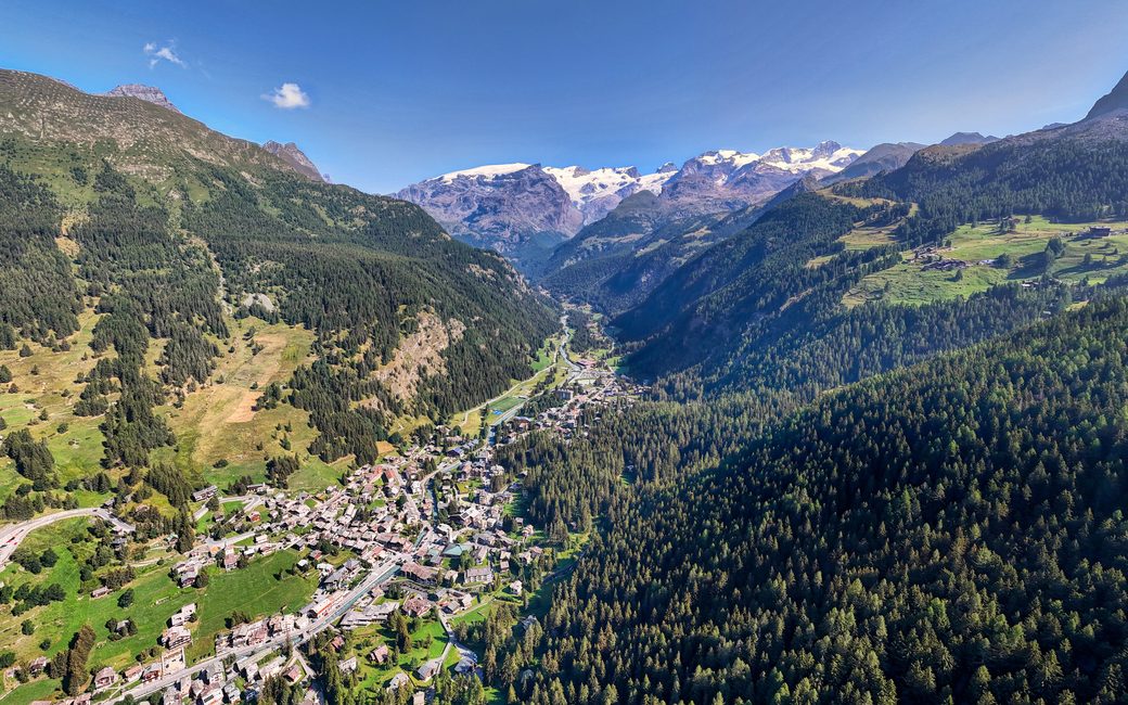
An aerial view down onto the village of Champoluc in a green valley, forested slopes rising on the right and snowy peaks of Monte Rosa on the horizon
C
Champoluc and the Val d’Ayas by Hagai Agmon-Snir CC BY-SA 4.0 Cropped for display.

A short, steady climb at 1,560–1,810 m from the centre of Champoluc up a forest path to the Mascognaz waterfall. The regional path register lists 1.6 km and 255 m of ascent, one way.

Distance
1.6 km
Elevation gain
255 m
Highest point
1814 m
Duration
50 min
Terrain
Village streets, then a forest path
Trail rating
Caution terrain
Area
Champoluc – Mascognaz waterfall, Ayas · Valle d'Aosta, Italy
Open the full trail guide →
1814 m 1560 m 1.6 km
Elevation profile: lowest 1560 m, highest 1814 m.

When to go

  1. January: Snow likely
  2. February: Snow likely
  3. March: Snow likely
  4. April: Snow likely
  5. May: Usually snow-free
  6. June: Usually snow-free
  7. July: Usually snow-free
  8. August: Usually snow-free
  9. September: Usually snow-free
  10. October: Usually snow-free
  11. November: Usually snow-free
  12. December: Snow likely

Snow is likely here from December to April.

Estimated from the walk’s high point (1814 m). No tourist board publishes this walk’s season, and every winter is different.

Where to start

Champoluc, the register’s start

How to follow this route

Directions: Path 14D: from the centre of Champoluc on the village road to the start of path 14D, then up the forest path to the Mascognaz waterfall, where it meets path 13A. Back the same way.

From ORMA's route audit of the official route description. Follow the mapped ORMA line and local signs.

Water on trail

Rifugi & refreshment

Good to know

Start in the centre of Champoluc: 1.6 km and about 250 m of climbing one way, under an hour to the waterfall, then the same way back. Keep your dog on a lead of at most 1.5 m and carry a muzzle.

Verified by ORMA on 27 Oct 2026. Check current conditions before setting out.

Is this trail right for your dog?

The trail rating above describes the mountain, and it's the same for every dog. How it suits yours depends on their build, age and health. See this route's match — scored for a medium dog until you add your own, free and in a minute.

Before you go: the dog safety guide · water for dogs on trail · dogs on cable cars · meeting a guardian dog

Nearby trails