ORMA logoORMA
All trails › Piedmont, Italy › Val di Susa

Alpe Toglie, Mattie

an old mule track through chestnut and beech woods to a mountain pasture, there and back
Best time: May to October Higher risk Verified by ORMA
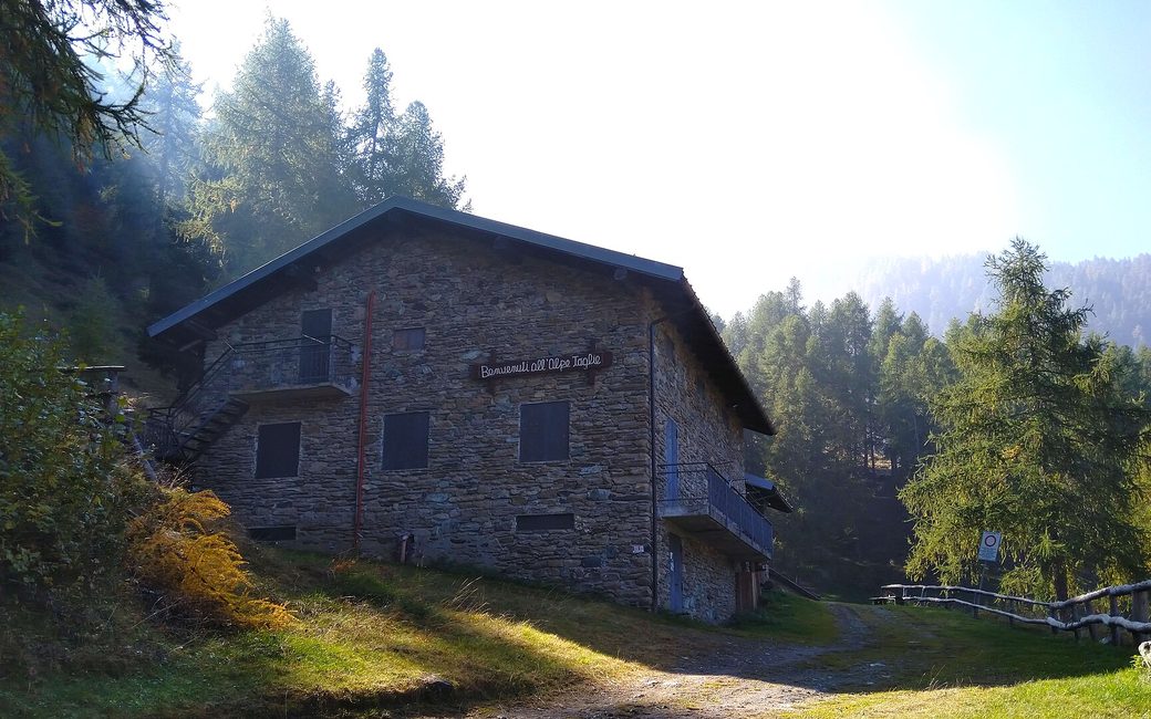
A stone mountain hut with a dark roof and balconies on a grassy slope among larches and firs, in autumn sun
C
The hut at Alpe Toglie above Mattie by Martj9 CC BY-SA 4.0 Cropped for display.

A climb from Mattie on an old mule track through chestnut and beech woods, past the remains of old hamlets, to the Cappella delle Toglie and the pastures of Alpe Toglie, then back the same way. The board lists 8.8 km and 773 m up.

Distance
4.4 km
Elevation gain
≈ 773 m
Highest point
1508 m
Duration
Not given
Terrain
Mule track, path and dirt road
Trail rating
Higher risk
Area
Mattie – Cappella delle Toglie – Alpe Toglie (Val di Susa) · Piedmont, Italy
Distance
8.8 km
Elevation gain
773 m
Highest point
1508 m
Duration
4 h
Terrain
Mule track, path and dirt road
Trail rating
Higher risk
Area
Mattie – Cappella delle Toglie – Alpe Toglie (Val di Susa) · Piedmont, Italy

Ends away from the start: plan a lift, bus or second car back.

Back the same way on the same path.

Open the full trail guide →
1508 m 772 m 8.6 km
Elevation profile: lowest 772 m, highest 1508 m.

When to go

  1. January: Outside the season
  2. February: Outside the season
  3. March: Outside the season
  4. April: Outside the season
  5. May: Recommended
  6. June: Recommended
  7. July: Recommended
  8. August: Recommended
  9. September: Recommended
  10. October: Recommended
  11. November: Outside the season
  12. December: Outside the season

Recommended from May to October.

Source: Outdooractive, read on 19 November 2026.

Where to start

The La Versina picnic area, Mattie, the board’s start

How to follow this route

This walk has no trail number of its own: follow these landmarks

Start at the La Versina picnic area in Mattie, the board’s start; park in the spaces next to it.

  1. The La Versina picnic area, Mattie
  2. Path 525 up through chestnut and beech woods past old hamlets
  3. Across the rio Corrente to the Cappella delle Toglie
  4. The dirt road to Alpe Toglie di Sotto and di Sopra
  5. Back the same way to La Versina

Directions: Val Susa Outdoor, checked 19 November 2026.

Rifugi & refreshment

Good to know

Start at the La Versina picnic area in Mattie: 8.8 km there and back and 773 m up, about 4 hours, as the board lists. The mule track is steep in places: allow time for your dog to rest.

Verified by ORMA on 19 Nov 2026. Check current conditions before setting out.

Is this trail right for your dog?

The trail rating above describes the mountain, and it's the same for every dog. How it suits yours depends on their build, age and health. See this route's match — scored for a medium dog until you add your own, free and in a minute.

Before you go: the dog safety guide · water for dogs on trail · dogs on cable cars · meeting a guardian dog

Nearby trails