 ORMA
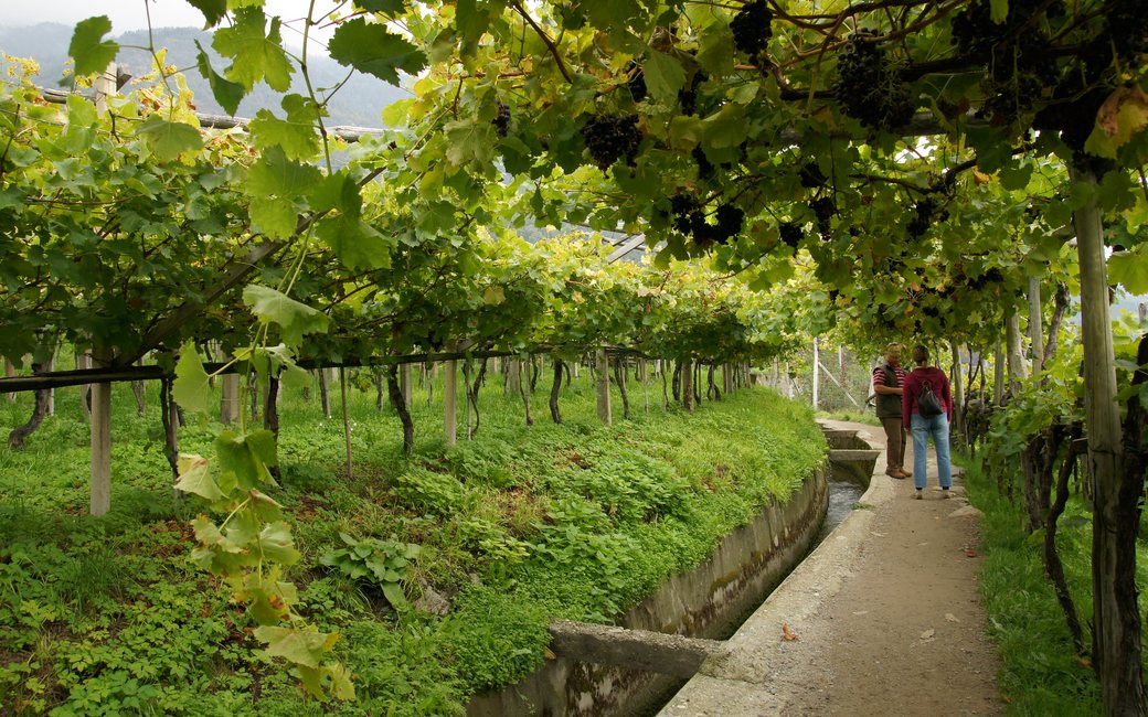
One of South Tyrol’s best-known irrigation-channel walks: almost level along the Algunder Waal from Oberplars through orchards, vineyards and vine pergolas above Algund to Gratsch, with views over the whole Meran basin. The official route lists 4.5 km, 29 m of ascent and 158 m of descent.
Snow is possible here from December to February.
Estimated from the walk’s high point (538 m). No tourist board publishes this walk’s season, and every winter is different.
March to June: ticks in the woods below about 1200 m, most of all from late May to mid-June. Check your dog after the walk.
Source: Province of Trento and Fondazione Edmund Mach, read on 9 November 2026.
June to September (an estimate): cows may be out on the pastures. Keep your dog close and give the herds a wide berth.
Source: South Tyrol tourist board, read on 9 November 2026.
Waalweg entrance at Oberplars by the Kneipp station, bus stop Abzweigung Oberplars (official start)
Directions: No route number: from the Kneipp station at Oberplars follow the “Algunder Waalweg” signs (AW) along the channel through Mitterplars and Algund-Dorf to Gratsch.
From ORMA's route audit of the official route description. Follow the mapped ORMA line and local signs.
Start at the Kneipp station at Oberplars (bus 213 or 235 to Abzweigung Oberplars) and follow the Algunder Waalweg signs along the channel to Gratsch: 4.5 km, almost level, about an hour. Keep your dog on a short lead (1.5 m at most) and out of the orchards and vineyards. The slope is sunny, so go early or late in summer; there is water at the start and near the end. Some dogs need coaxing over the suspension bridge at Gratsch.
The trail rating above describes the mountain, and it's the same for every dog. How it suits yours depends on their build, age and health. See this route's match — scored for a medium dog until you add your own, free and in a minute.
Before you go: the dog safety guide · water for dogs on trail · dogs on cable cars · meeting a guardian dog