ORMA logoORMA
All trails › Savoy, France › Chambéry – Bauges

Boucle du Lac de la Thuile

the Lac de la Thuile loop

Best time: March to November Low-risk terrain Verified by ORMA
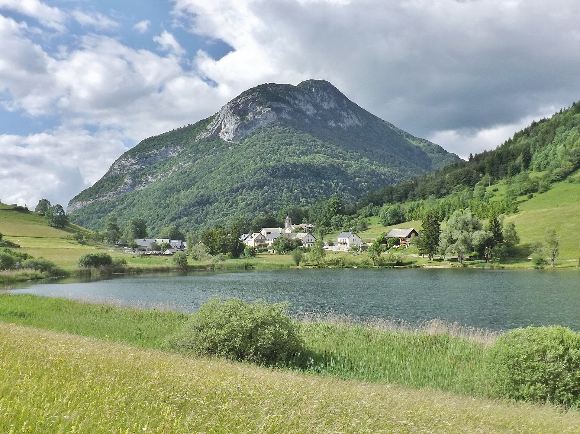
Lac de la Thuile in early summer, the village and its church on the far shore beneath a forested limestone peak, long meadow grass in the foreground
C
Lac de la Thuile and the village by Florian Pépellin CC BY-SA 3.0 Cropped for display.

A gentle 2 km loop round the Lac de la Thuile, the only natural lake in the Bauges, below the village of La Thuile at about 874 m: a dirt path along the south shore, the quiet lake road along the east shore past the inn and the town hall, and back past the cemetery.

The lake is a protected natural area and private ground: the commune allows dogs on a lead, forbids letting them off, and asks you to pick up after them. Just over half the loop is on quiet tarmac where cars can come at any moment, the dirt sections can be wet, and there is little shade. Keep your dog off the meadows and the reed beds.

Distance
2 km
Elevation gain
20 m
Duration
45 min
Terrain
Accessible lakeside path, paved and packed dirt
Trail rating
Low-risk terrain
Area
La Thuile – Bauges · Savoy, France
Open the full trail guide →

When to go

  1. January: Snow possible
  2. February: Snow possible
  3. March: Usually snow-free
  4. April: Usually snow-free
  5. May: Usually snow-free
  6. June: Usually snow-free
  7. July: Usually snow-free
  8. August: Usually snow-free
  9. September: Usually snow-free
  10. October: Usually snow-free
  11. November: Usually snow-free
  12. December: Snow possible

Snow is possible here from December to February.

Estimated from the walk’s high point (894 m). No tourist board publishes this walk’s season, and every winter is different.

Where to start

Village-hall car park (salle des fêtes), La Thuile (official start)

How to follow this route

This walk has no trail number of its own: follow these landmarks

Start at the village-hall car park (salle des fêtes) in La Thuile, the tourist office’s start.

  1. With the village hall on your right, head straight across the field towards the small wood.
  2. A dirt path runs along the lake and meets the road after a few minutes.
  3. Turn left and follow the road for 100 m, then keep left at the junction. You walk along the lake for about 10 minutes on a tarred lane.
  4. Pass the lake inn on your right, then the town hall, and head into the village.
  5. Turn left past the cemetery. A few more minutes on the road bring you back to the start. Watch for cars on this stretch.

Directions: Grand Chambéry Alpes Tourisme, checked 30 October 2026.

Water on trail

Good to know

Start at the village-hall car park (salle des fêtes) in La Thuile, the official start. A tap is mapped by the lake car park and public toilets stand near the town hall; carry water on hot days.

Verified by ORMA on 22 Oct 2026. Check current conditions before setting out.

Is this trail right for your dog?

The trail rating above describes the mountain, and it's the same for every dog. How it suits yours depends on their build, age and health. See this route's match — scored for a medium dog until you add your own, free and in a minute.

Before you go: the dog safety guide · water for dogs on trail · dogs on cable cars · meeting a guardian dog

Nearby trails